![]()
FlightBook
Downloads
Support
Dev Notes
Contacts
Latest developements
A number of problems associated with foreign versions of Windows have been resolved. These problems resulted in run-time errors and were associated with alternate date formats.
I have been working on the next release (version 2.9) and expect to produce two version, one for NT complied for DirectX3 and a standard version for DirectX6. The majority of the changes will be to the 3Dplot functionality for better realism. The addition of clouds made a requirment for more fields in the log database and a re-organization of the user-interface.
Changes have been made toEditior to fix some bugs and to be able to extract data from raw XYZ files since locating a source of 50m OS data from e-Map.com. I also intend to dump the DEM compatability in Flightbook and create an extraction routine in editior to create XYZ files.
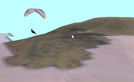
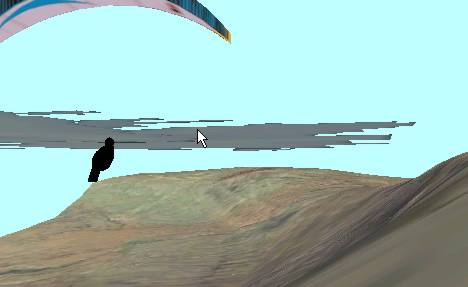
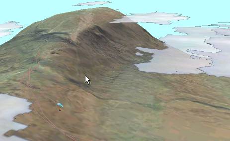
Below are some screen-shots from the latest beta.
The images are from a recent soaring flight on Inglebough Yorksire Dales. The Inglebough landscape was created using an image obtained from the millenium-mapping project at www.getmapping.com, raw XYZ data from OS 50m Elevation data purchaced through www.e-map.com, and the latest beta Landscape Editor program.
Beta Downloads
Flightbook Beta for DX3 Latest NT Beta compiled for DirectX3 and for thoses that donot have or want to install higher DX levels Flightbook Beta for DX6 Latest 95/98 Beta complied fro DirectX6. Editior Beta Latest Editor (not available at this time) NOTE: To use the beta versions it is recommened that you back up the exisiting files before overwrighting them with the content of the zip files.